Interpreting satellite images
It is easy to look at a satellite image, but there is an art to interpret what is on the image along with what it means. To illustrate this, this morning’s two NOAA 18 passes combines makes it look like there is no cloud over most of New Zealand other than a bit across the centre of the South Island.
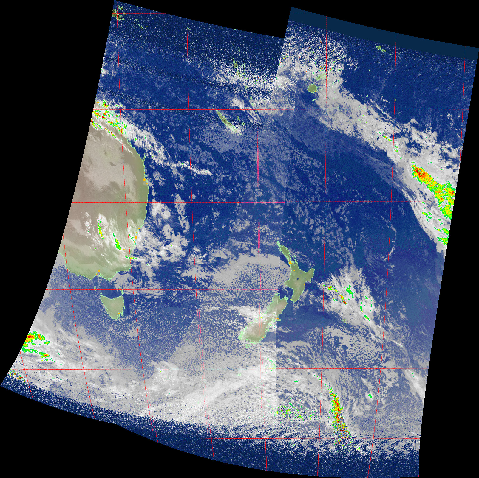
Looking at the visible pass data from the NOAA 18 pass over New Zealand, this seems to be aligned with the false colour image with little cloud being visible. However this is using a single wavelength and what it really means is that there is little cloud visible which is reflecting the wavelength that the sensor is detecting.
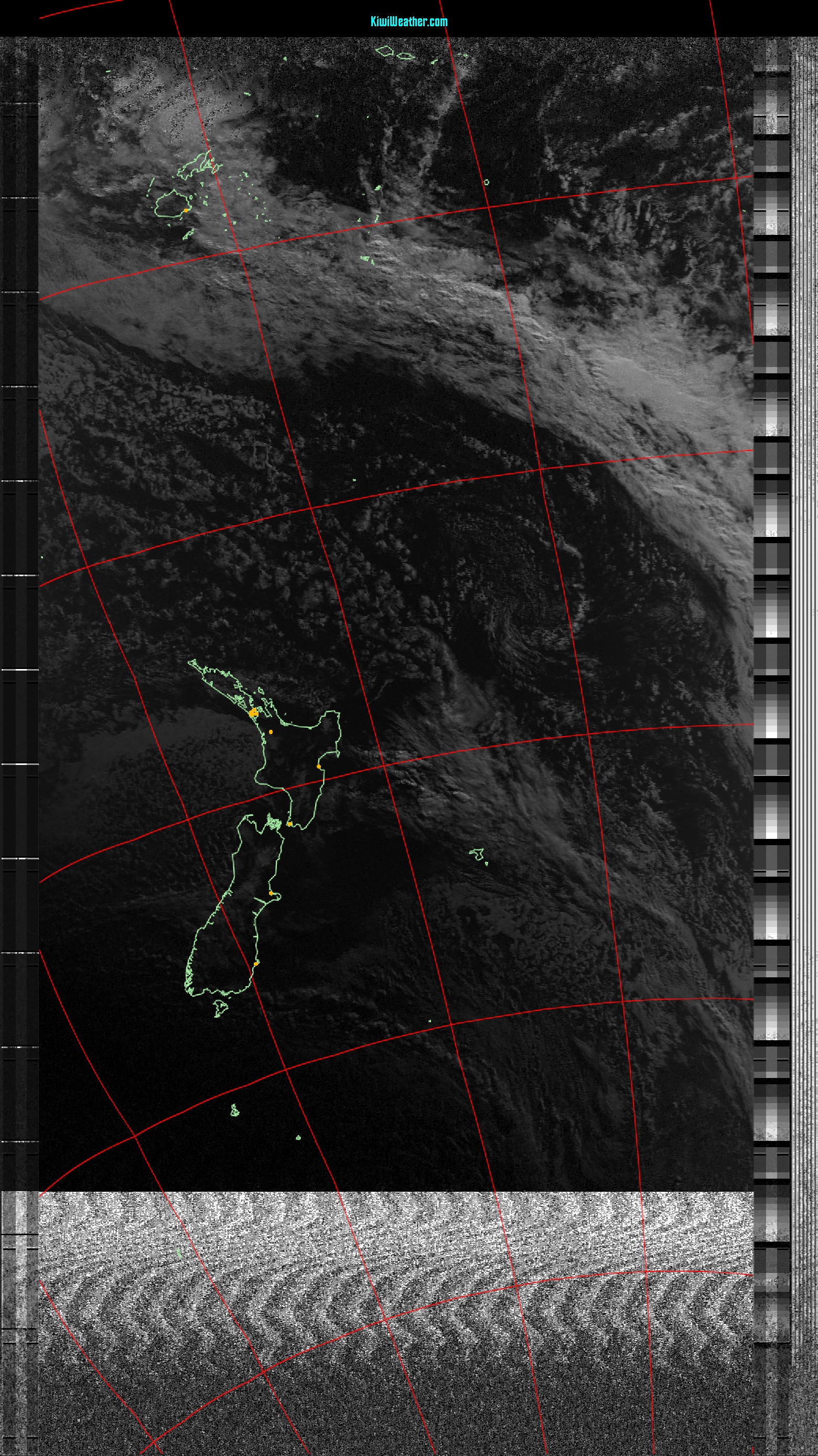
However looking at the Meteor M-2 pass which was to the east of New Zealand, but it will have included New Zealand in the image we see a different story. There is no sign of New Zealand, even with this image which has been processed using histogram equalisation to highlight the areas where it was still around dawn. The entire area is covered with large areas of cloud.
Note that this image is made up from red, green and blue light from three sensors which is combined into a colour image. So what we are seeing is that these sensors are seeing the cloud.
And of course there is always that useful reference point from looking out the window and seeing that there is extensive cloud cover over Auckland, however it is mostly light cloud.
The light cloud will account for the NOAA 18 data which is not seeing the cloud, plus the enhancement shows that there is little rain in the images (although there is very, very light rain showers here).
And the Meteor M-2 image is probably the best for seeing what it really looks like, however it isn’t giving the same enhancements that NOAA 18 is.
Another factor is the difference in resolution between the two satellites, with a pixel in the NOAA 18 image being about 4km x 4km and in the Meteor M-2 image being about 1km x 1km. So the Meteor image can resolve some of the breaks in the cloud cover than NOAA couldn’t resolve.