GOES 17 and Hurricane Douglas Approaching Hawaii
I’m still very much in learning mode for getting GOES 17 images, not helped by the fact that from our property there are very few places where trees are not in the way, especially one very tall palm tree on a neighbouring property.
So for now I’m limited do having the dish point out of a first floor room with a sliding door wide open and with it being winter, this cuts down things to warmer, drier weekend days.
It is also very much a case of experimenting to find out what helps improve the signal and equally what doesn’t. The lesson learnt today was that a laptop is great at adding noise to the signal, so turning it off and connecting using a PC from another room helps a lot, but makes it a lot harder to aim it accurately!
But I’ve been getting more images which is a distinct improvement!
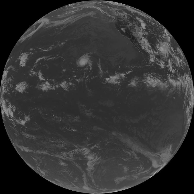
Great to see a full disk image, especially with the storm system which is just north of the equator, in the centre of the image.

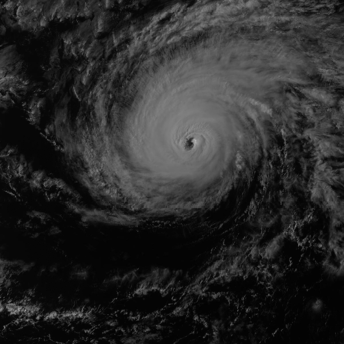
I’ve caught three close in views of this storm, which is obviously of interest to NOAA (who run GOES 17).
Searching via Google News identifies this as the category 4 hurricane Douglas, which is expected to hit Hawaii this weekend (so no wonder it is being watched), with more detail on this Washington Post story.
Interestingly, the story uses an image from GOES West (i.e. GOES 17).
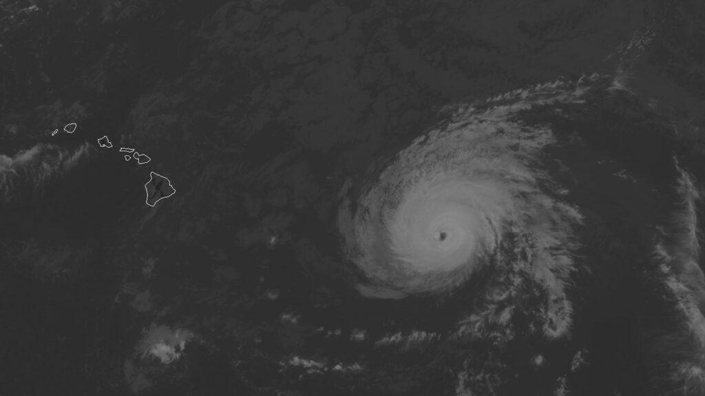
With having three of the close in views, I’ve created a simple animation to show the movement between the three images, with each frame being captured 15 minutes apart.
One Reply to “GOES 17 and Hurricane Douglas Approaching Hawaii”