(Almost) Global Viewpoint – Part 2
I’d recently managed to stitch multiple satellites together using Sanchez, as described in an earlier post. However I was missing most of Africa and Europe.
Luckily, two other satellite downloaders (among their many skills), zbychu and Aang23 have been able to download data from the EWS-G1 satellite and decode it. This satellite is the former GOES 13 weather satellite which is now run by the US Space Force.
The are kindly allowing me to use the data they are downloading to add to me merged images from multiple geostationary weather satellites.
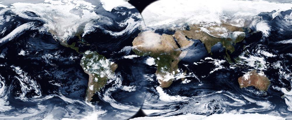
The result is to capture just about the full globe, other than small areas to the north of the UK and a small area in the same position in the southern hemisphere, plus of course from the poles.
The new images will be pulled into the video animation, although until I’ve got 3 days worth of data it’ll be mainly showing the view pre-EWS-G1.
Now I just need to get data from satellite(s) which covers these gaps.
The most likely option is the Russian Electro L-2, once I get a source for the data since it is not downloadable from New Zealand.