Meteor M-2 Images Turbocharged
For quite a while I’ve been posting Meteor M-2 images covering New Zealand and the surrounding areas with relatively few changes other than adding the image header and doing a bit to remove some of the image noise.
However seeing some posts on Reddit where people had been using MeteorDemod, it was obvious that there was significant room for improvement in what I am displaying on this website.
With all the code being on GitHub, I soon had it installed, first on a Pi, then also on a virtual machine on my desktop PC, with a little help from the creator of MeteorDemod (big thanks!). Working on integrating it into wxcapture is a lot quicker on a desktop but then a Pi does incredibly well given the hardware and price point (a lot cheaper than my desktop).
What MeteorDemod does is to give access to more of the image channels available, over and above the visible channels I’d been using. And that is just the start of the improvements, to list just a few:
- Image processing to highlight rain
- Thermal images
- IR images
- Mercator and equidistant projections
- Noise removal / camouflage (incredibly well done)
- Ability to create composite images
- Positioning an X (or other shape) to show where the image was captured from
- Adding longitude and latitude lines on projections
- Adding country borders
- Adding place names
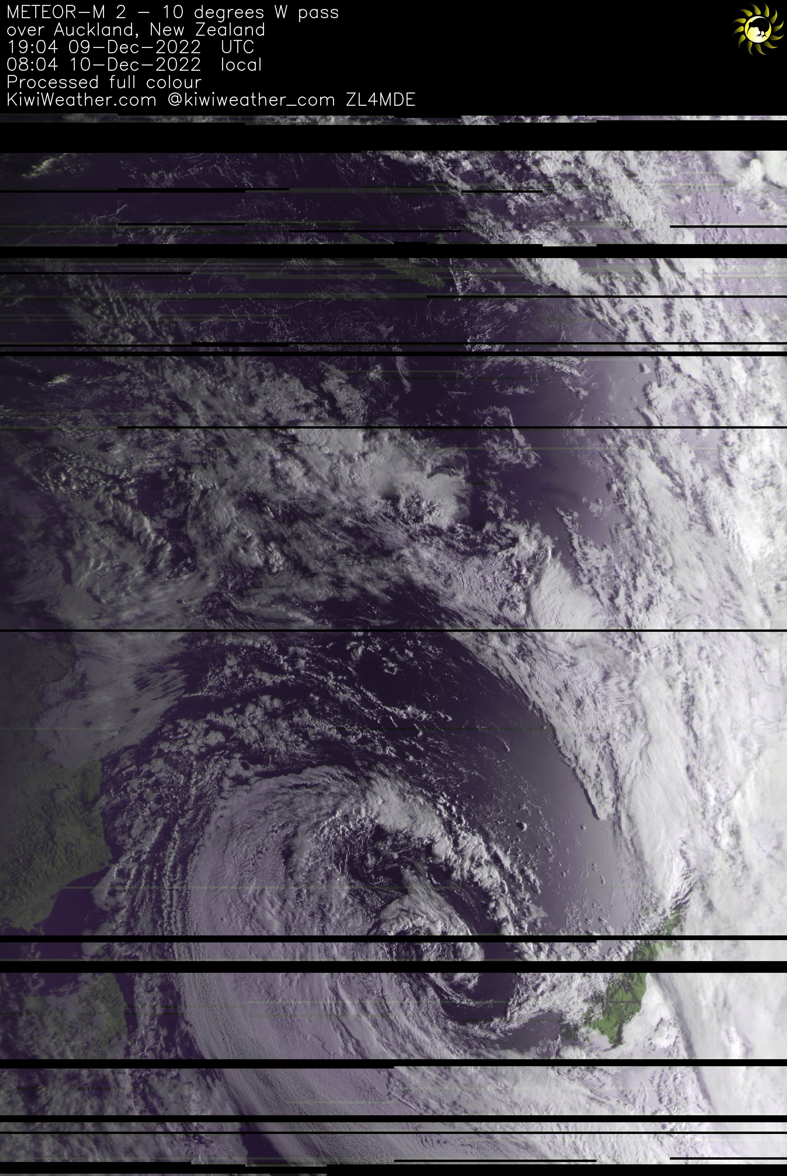
So of course I was excited to see what I could get working, with the audio capture from the original image above being a natural test.
At the moment, it does take a bit of experimentation as there is limited documentation available, however this is more than made up with amazing support from the creator. At first this was by raising issues on GitHub, but then via Discord with the APT server where there are a few hundred members.
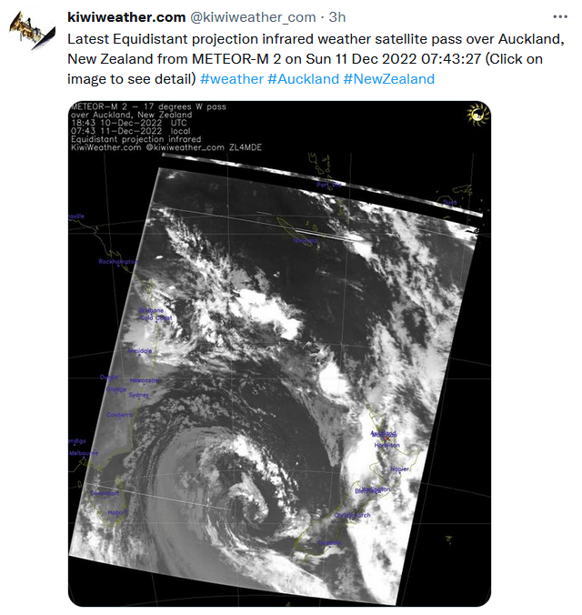
The full set of images I’m generating can be seen on the main Kiwiweather page for the pass (link), with the code updated to always generate these images.
Picking just one image to show here,
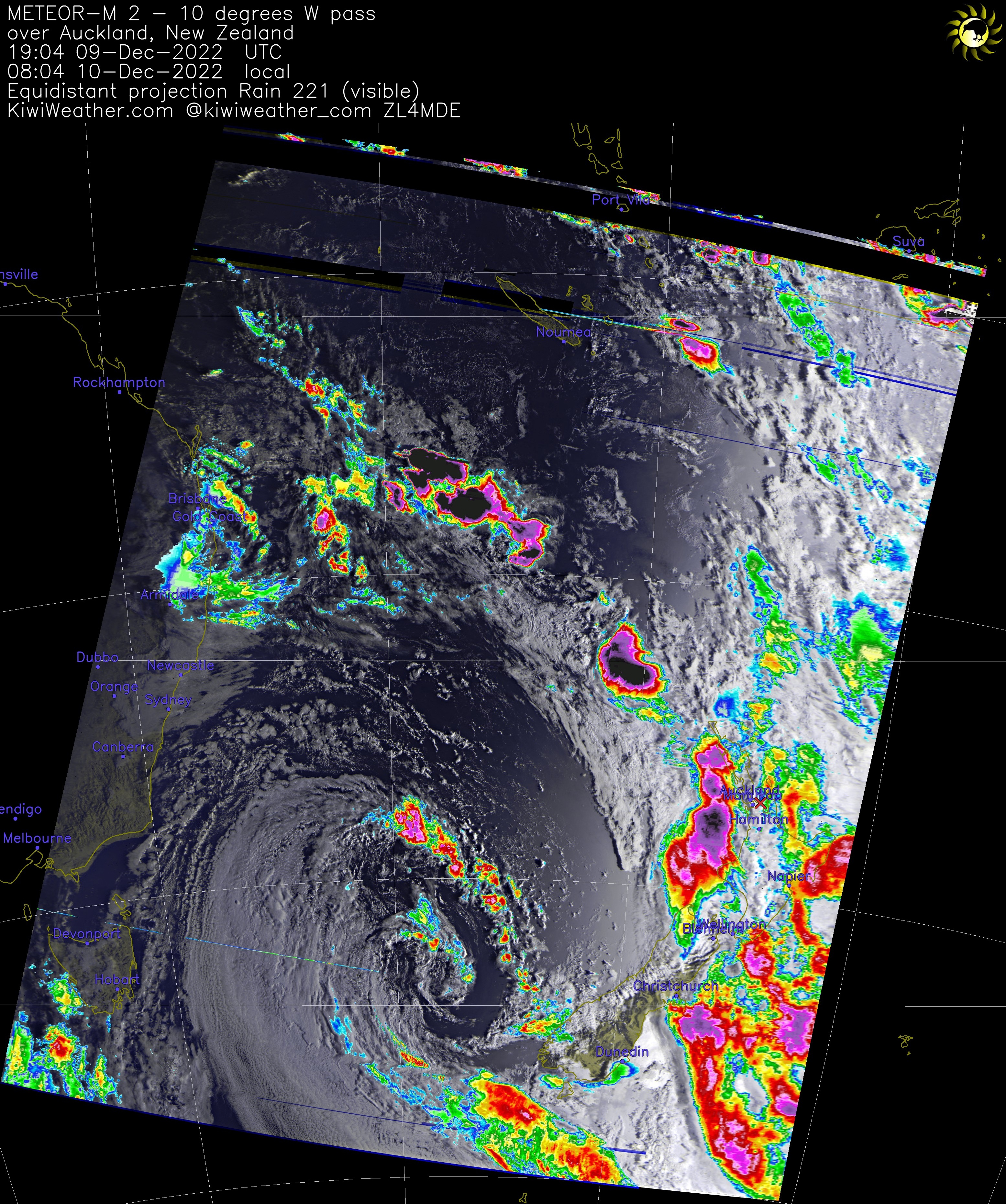
The level of detail isn’t obvious when viewed at this size, with the real level coming out when you click on the full size image and zoom in.
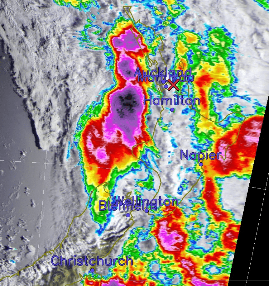
Detailed zoom into the Meteor M-2 visible light image with rain highlighted
This really lets anyone see exactly what the weather looks like and exactly where it is. Previously when it was cloudy, often trying to spot where New Zealand was took a lot of effort and some guesswork! And yes, that was a pretty intense storm with flooding in parts of New Zealand and some good thunderclaps too.
These images are now also being sent to a few Discord servers using webhooks and are also being tweeted. I can easily send these to other servers on request.
I still need to get the Mercator projection functionality working, which seems to be dependent on a code fix for MeteorDemod as it hits issues where images cross the international date line. Hopefully the creator has some free time at some point to fix this.
There is the ability to do composite images, combing the results from multiple passes to get an even better view of this part of the world. I’m already in discussions with another ham over in Australia to combine our passes to cover most of Australia and New Zealand.