Polar Capture
This site tracks, captures and releases data from weather satellites with polar orbits that take them over New Zealand.
You will find images which were tracked, captured and released from these satellites via the captures page.
The website is built around a software / hardware solution which will:
- Track – when satellites will be overhead
- Capture – the image data which is broadcast
- Release – the decoded images
Track
Satellites orbit around our planet and it is possible to compute when a satellite will make a pass over a location. The best passes for image capture being when a satellite is making a high elevation pass, which means that it will spend a longer time and there will be a better signal for most of the pass.
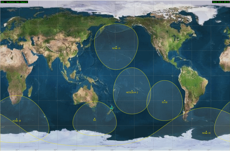
The orbits are typically around 800km (500 miles) up with each orbit taking around 100 minutes. The longest a satellite will be visible overhead is about 15 minutes with a high elevation pass with this dropping down to about 10 minutes for a much lower pass.
Capture
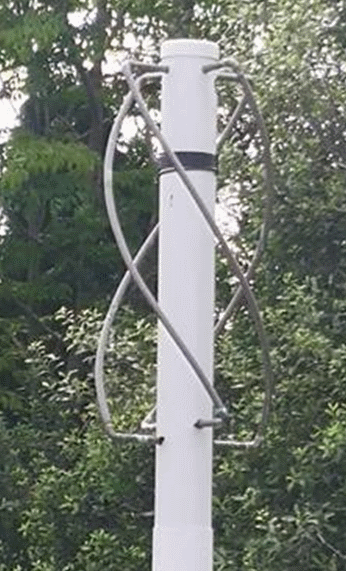
When one of the satellites we capture is about to come over the horizon, signal capture is started. We are using a QFH (Quadrifilar Helix Antenna) which is a specialized antenna designed for the frequency band that these satellites use and for the right-hand circular polarization.
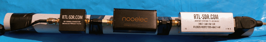
The antenna is connected via:
- An FM band block filter – to filter out the strong FM radio signals
- An LNA (Low Noise Amplifier) – to amplify the weak satellite signals
- A SDR (Software Defined Radio) – to convert the signals into digital data
The digital data is fed into a Raspberry Pi single board computer where it is first stored as an audio file before being processed to create the different image enhancements which are available, depending on the type of satellite being captured and which sensors are active on the satellite.
Release
Once decoded, the images are released to the world via:
- This website – https://kiwiweather.com
- Twitter – @kiwiweather_com
- Discord – webhooks to selected servers on request