GK-2A Graphics
These are the latest graphics downloaded from the GK-2A weather satellite. The graphics do not, yet, auto-refresh, so you’ll need to reload this page to get any updates.
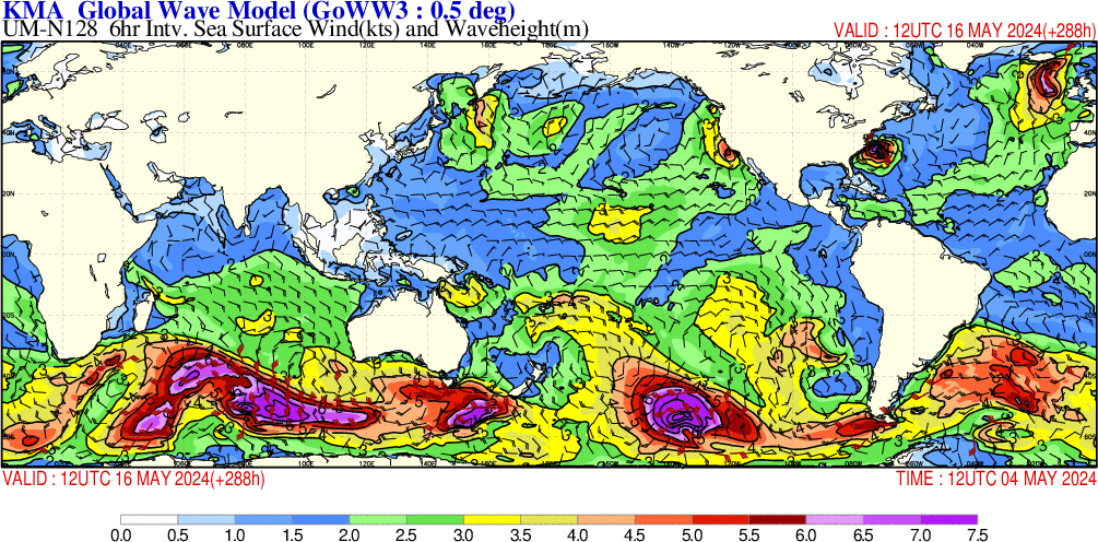
Global – Wave Model
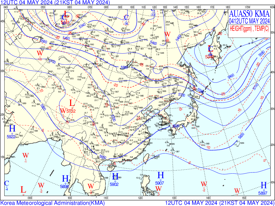
SE Asia – Pressure and Temperature
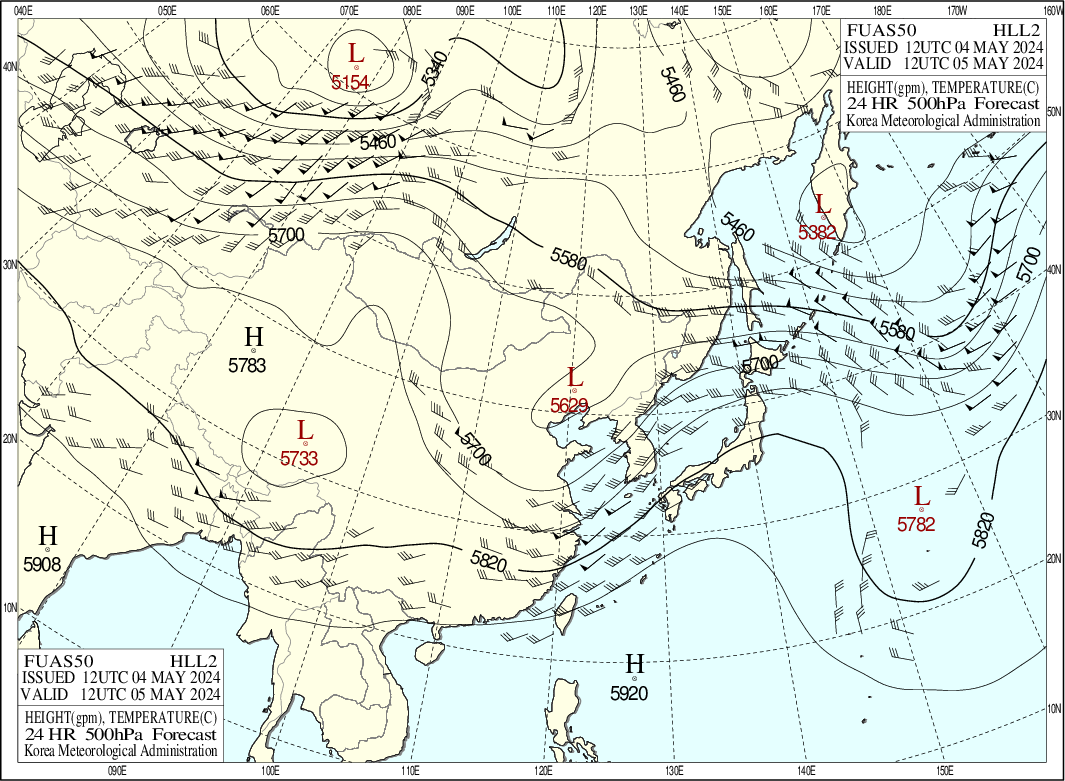
SE Asia – Wind and Temperature Forecast (Today)
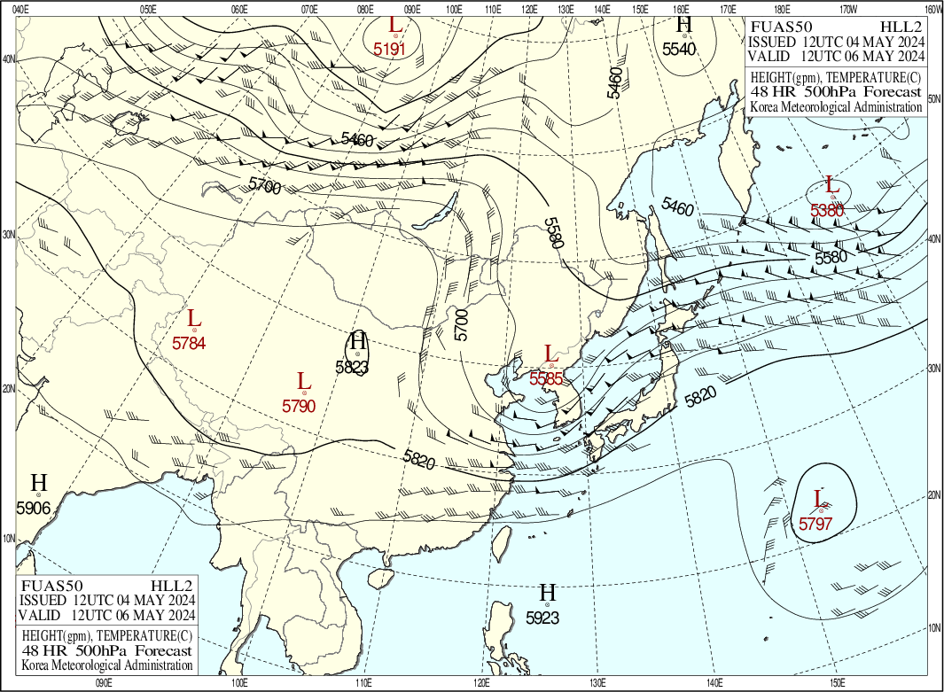
SE Asia – Wind and Temperature Forecast (Tomorrow)
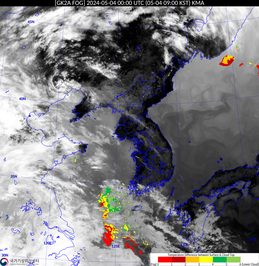
Korea – FOG
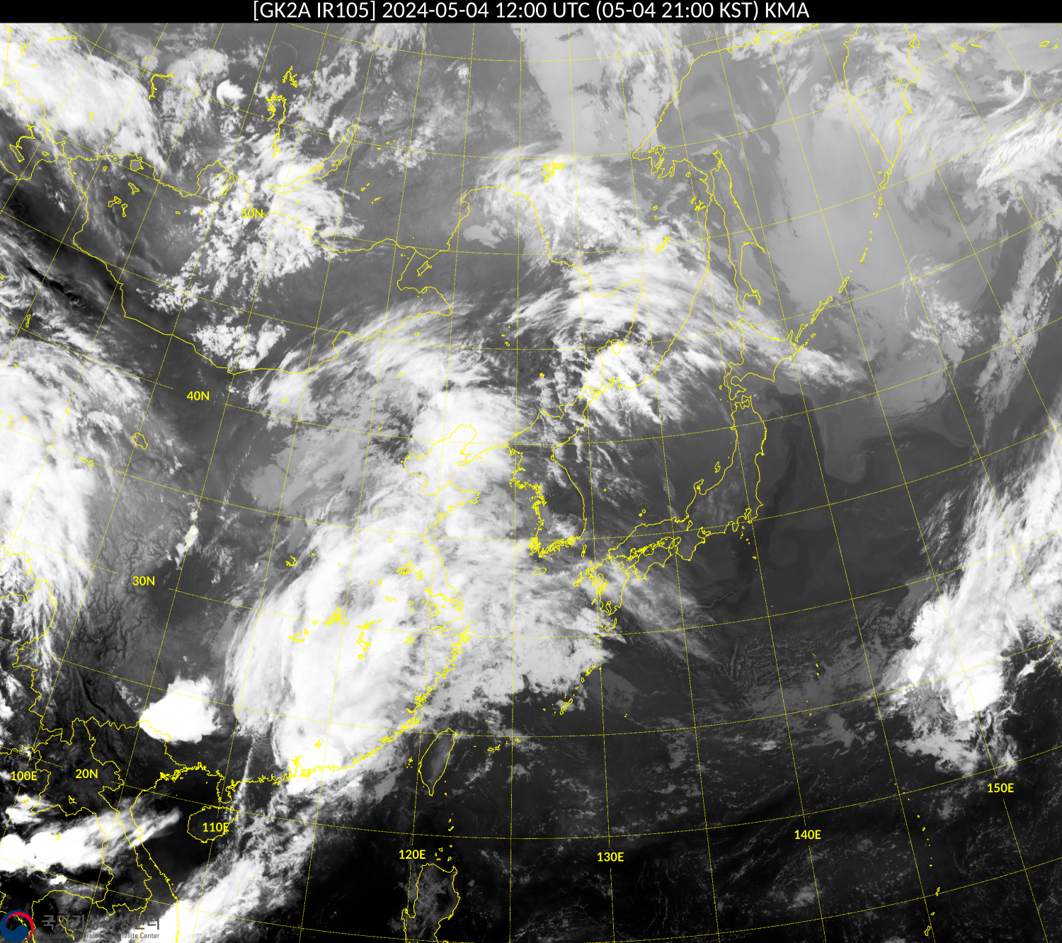
Korea – IR Detail with Borders
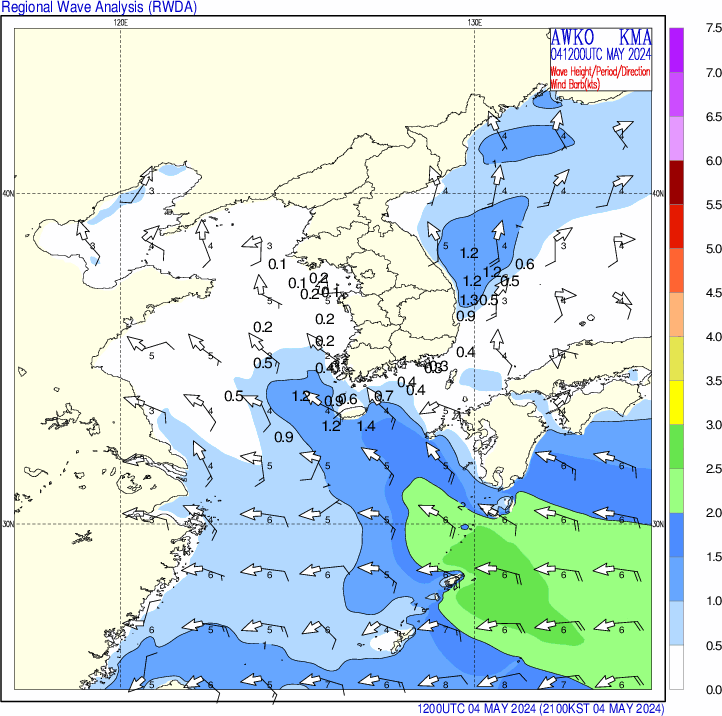
Korea – Wave Analysis
Korea – Wave Model

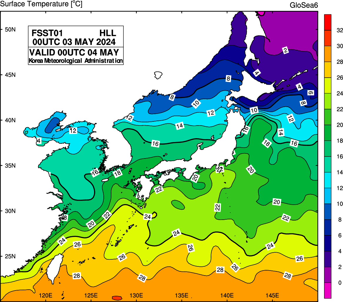
Korea – Sea Surface Temperature

Korea – Sea Surface Temperature Prediction (Today)
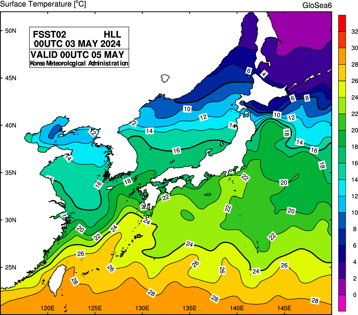
Korea – Sea Surface Temperature Prediction (Tomorrow)
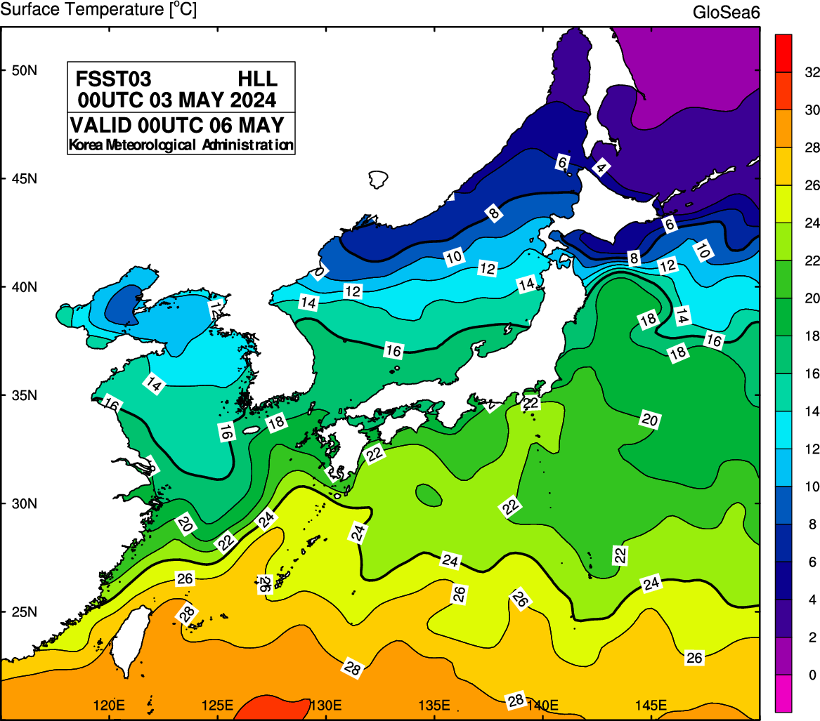
Korea – Sea Surface Temperature Prediction (Day After Tomorrow)
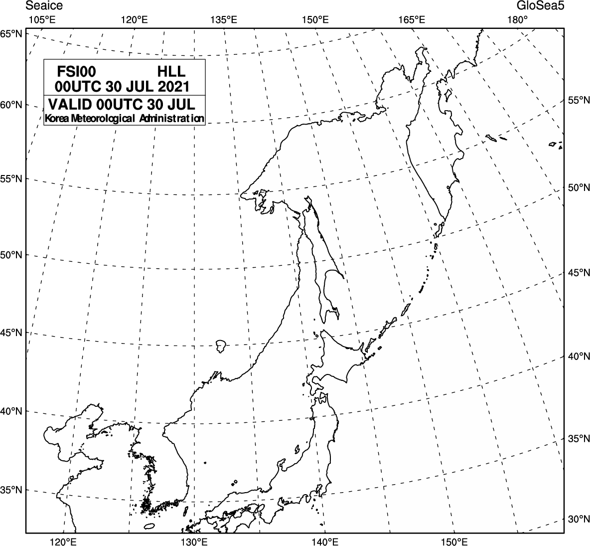
Korea – Sea Ice
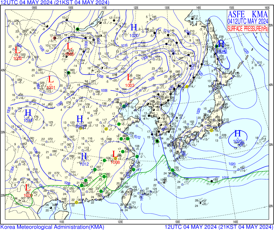
Korea – Surface Pressure
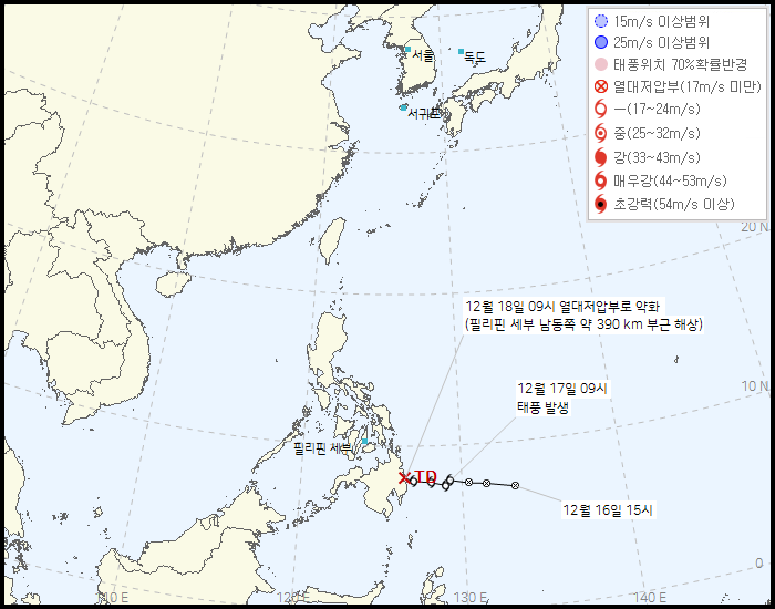
Korea – Typhoon Path (A)
The key for this can be translated to English as:
- 15m/s abnormal range
- 25m/s abnormal range
- Typhoon location 70% probability radius
- Typhoon centre route
- TD centre path
- Probability radius centre
The labels show:
- The date time with the month first, then the day of the month, followed by the hour using a 24 hour clock
- The location with the format of country and city
- The estimated wind speed, e.g. 190km, being 190kmph and the wind direction. There is also text to indicate if the data point is on land or at sea, which should be obvious from the map
- The red X shows where the typhoon will cease to be classified as a typhoon
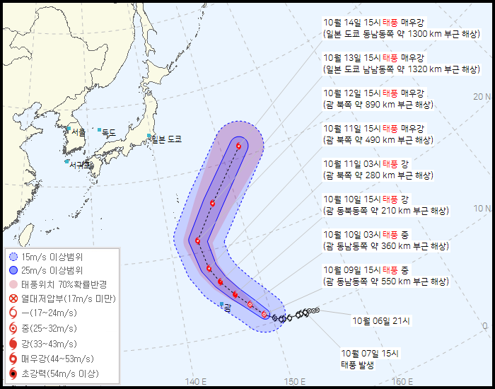
Korea – Typhoon Path (B)
The key used and labels are as per the previous section.
Satellite Data
This is information about the satellite, the schedule for what images will be transmitted at what time and any engineering data.