GOES 17 Graphics
These are the latest graphics downloaded from the GOES 17 weather satellite. The graphics do not, yet, auto-refresh, so you’ll need to reload this page to get any updates.
To see the images at full size just click on the image and it will open in a new tab.
These graphics are created from data that has been downloaded by Zl1LAC / Leith Cullen and are displayed here with thanks.
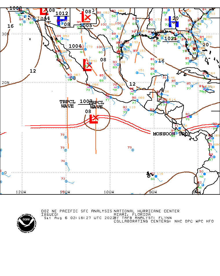
Surface Analysis – North East Pacific
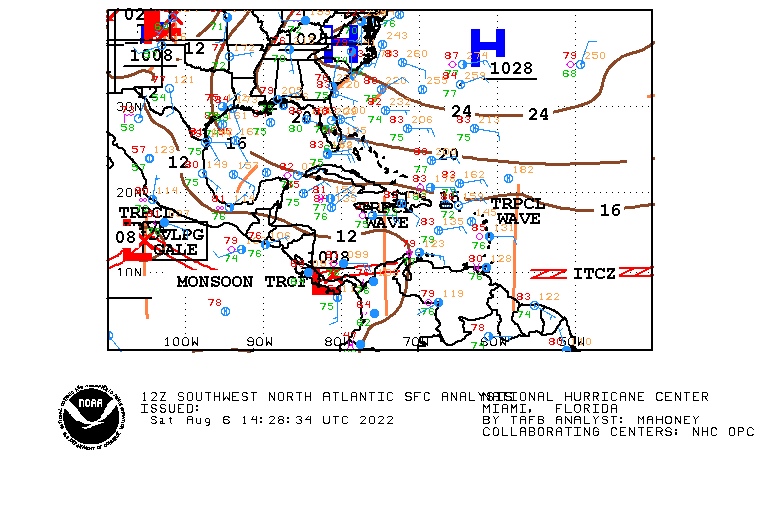
Surface Analysis – North Atlantic
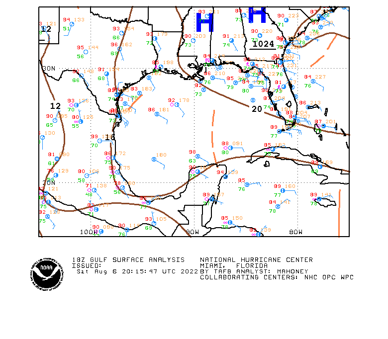
Surface Analysis – Gulf of Mexico
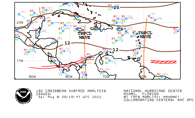
Surface Analysis – Caribbean
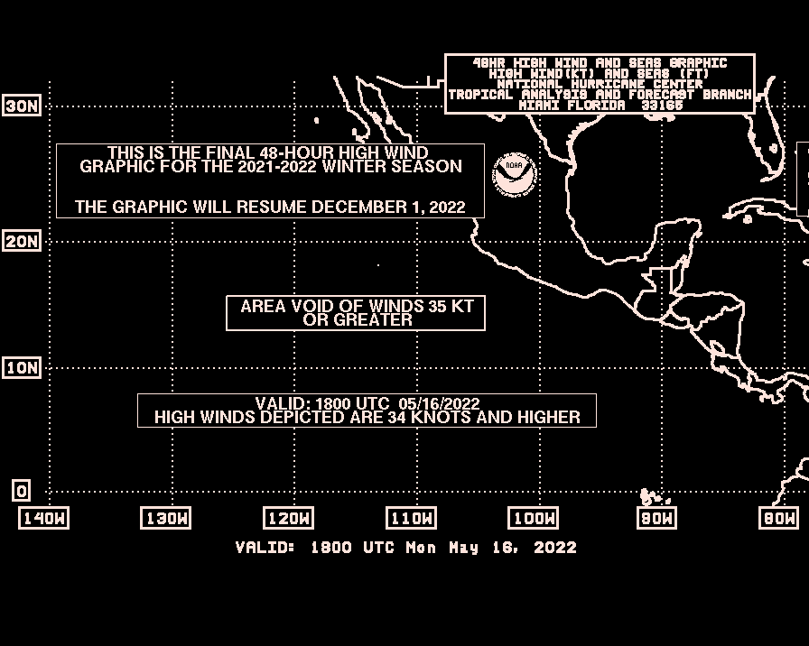
High Winds – Pacific
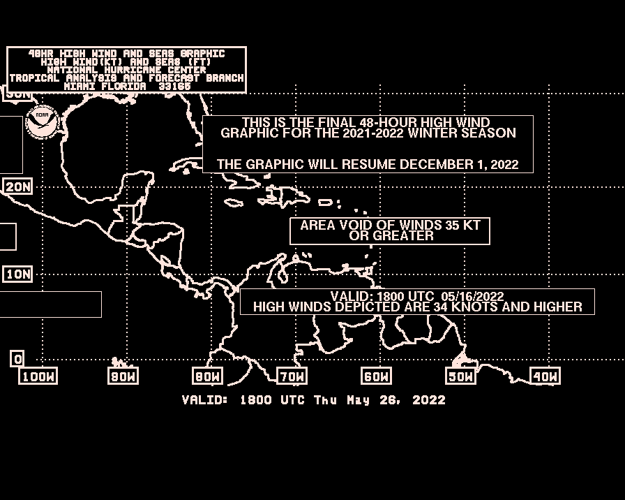
High Winds – Atlantic
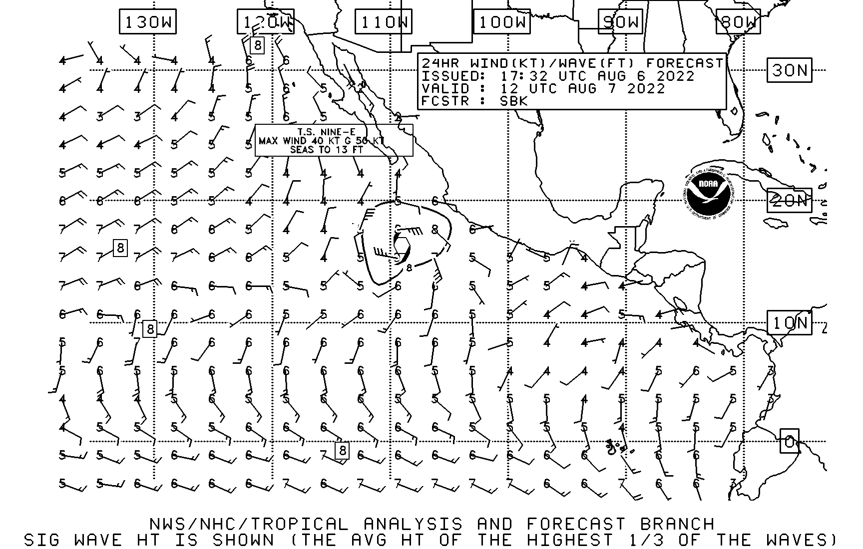
Next 24 Hours Wind and Wave Analysis – North / Central Pacific
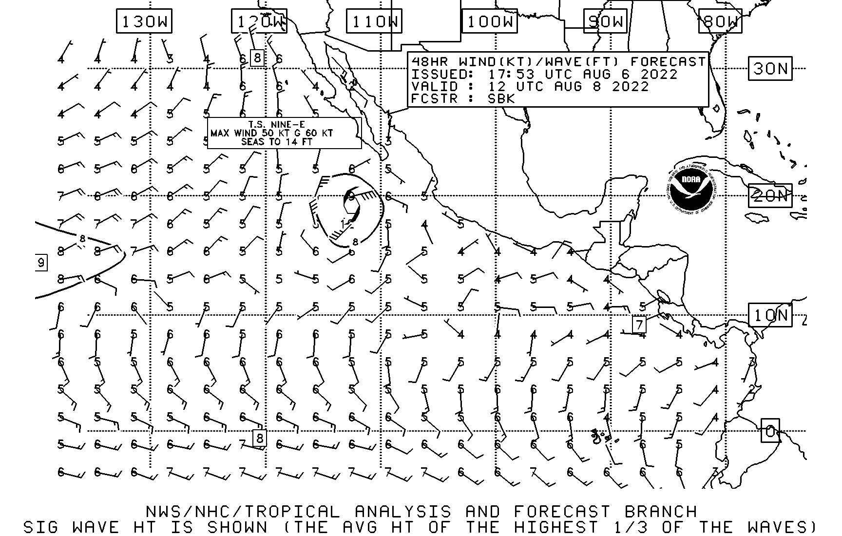
Next 48 Hours Wind and Wave Analysis – North / Central Pacific
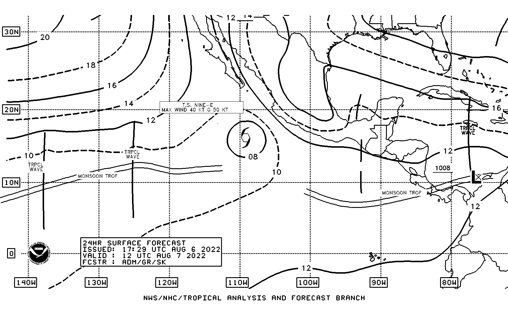
Next 24 Hours Surface Forecast – North / Central Pacific
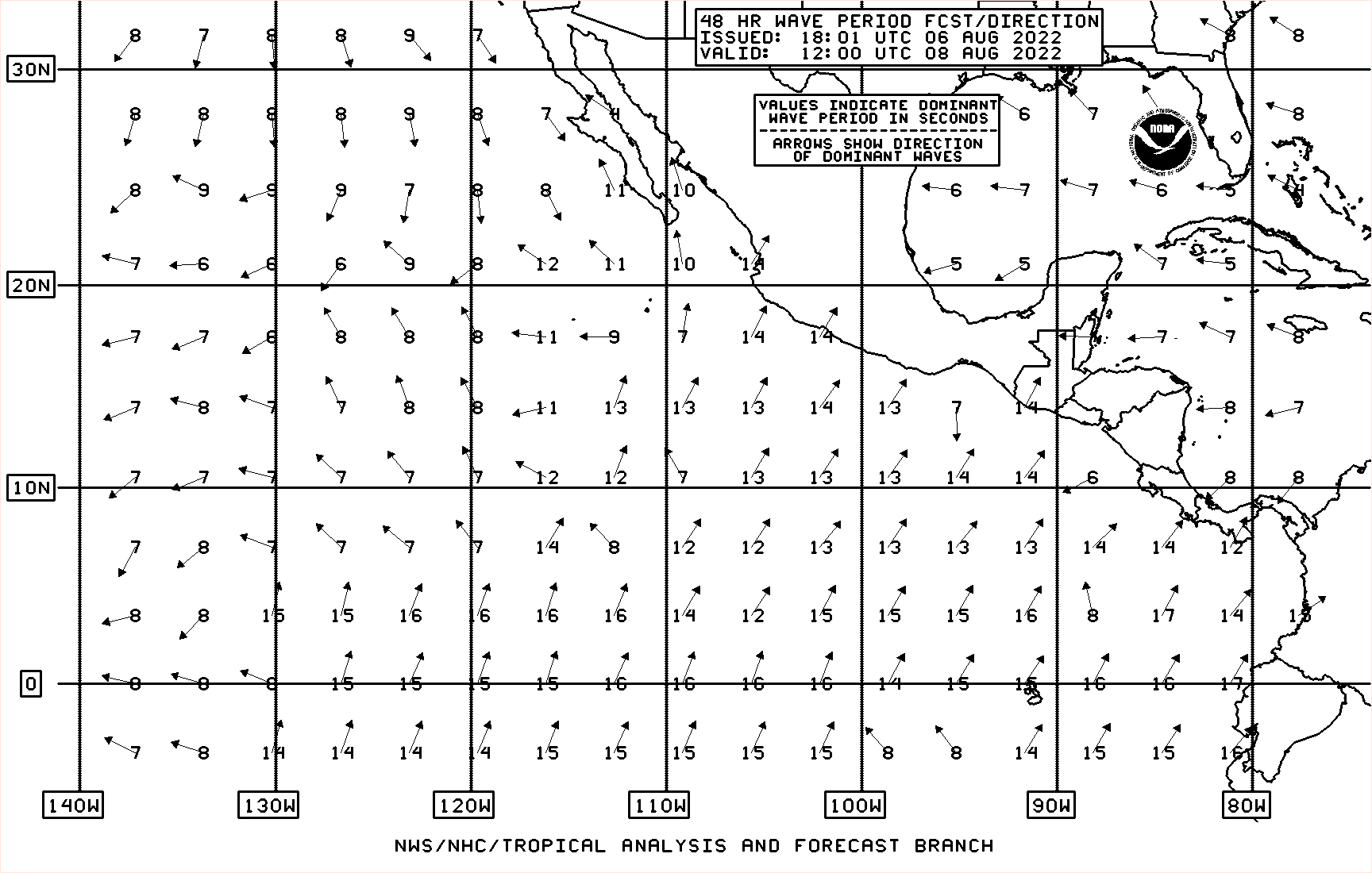
Next 48 Hours Wave Forecast – North / Central Pacific
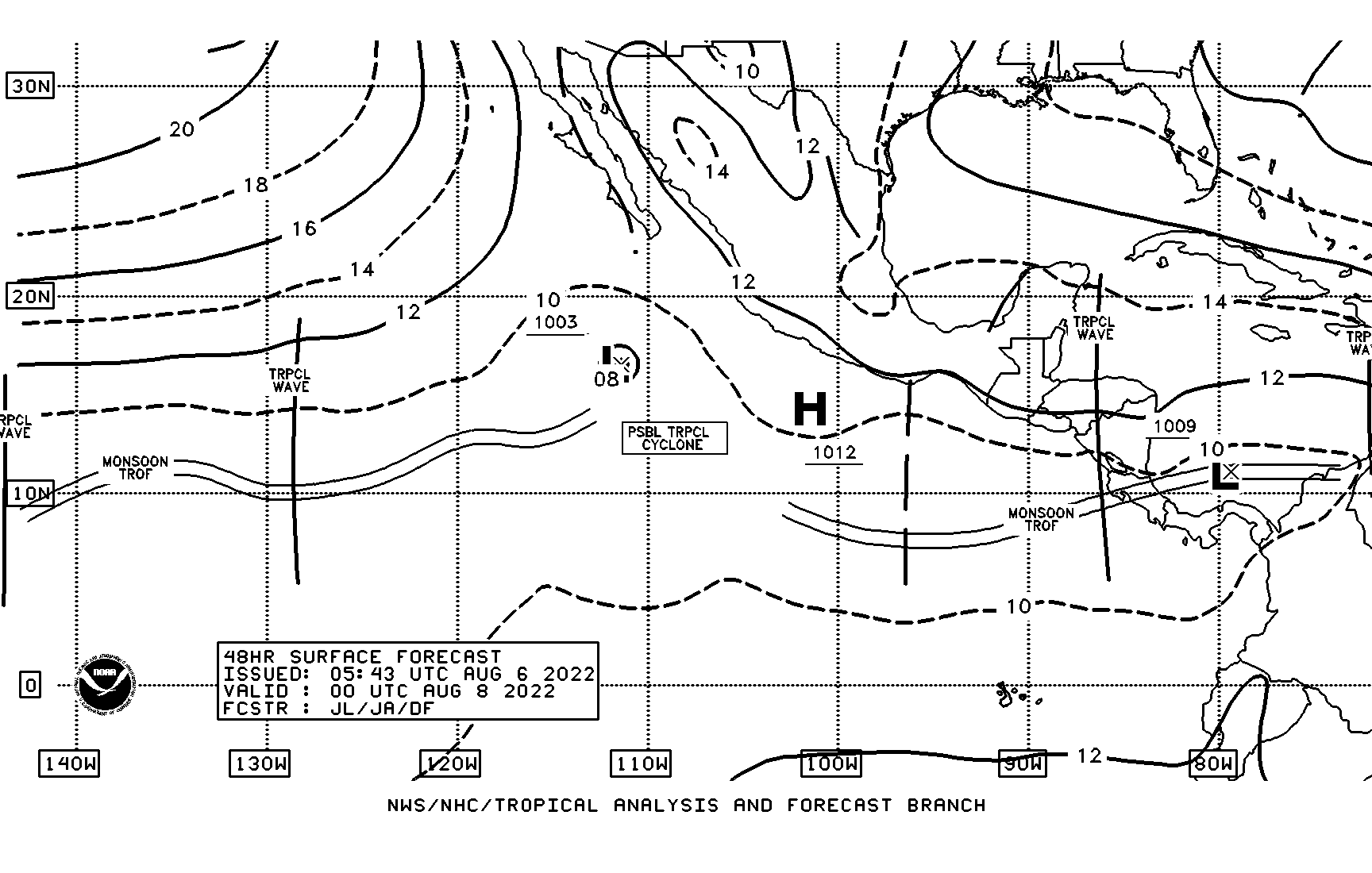
Next 48 Hours Surface Forecast – North / Central Pacific
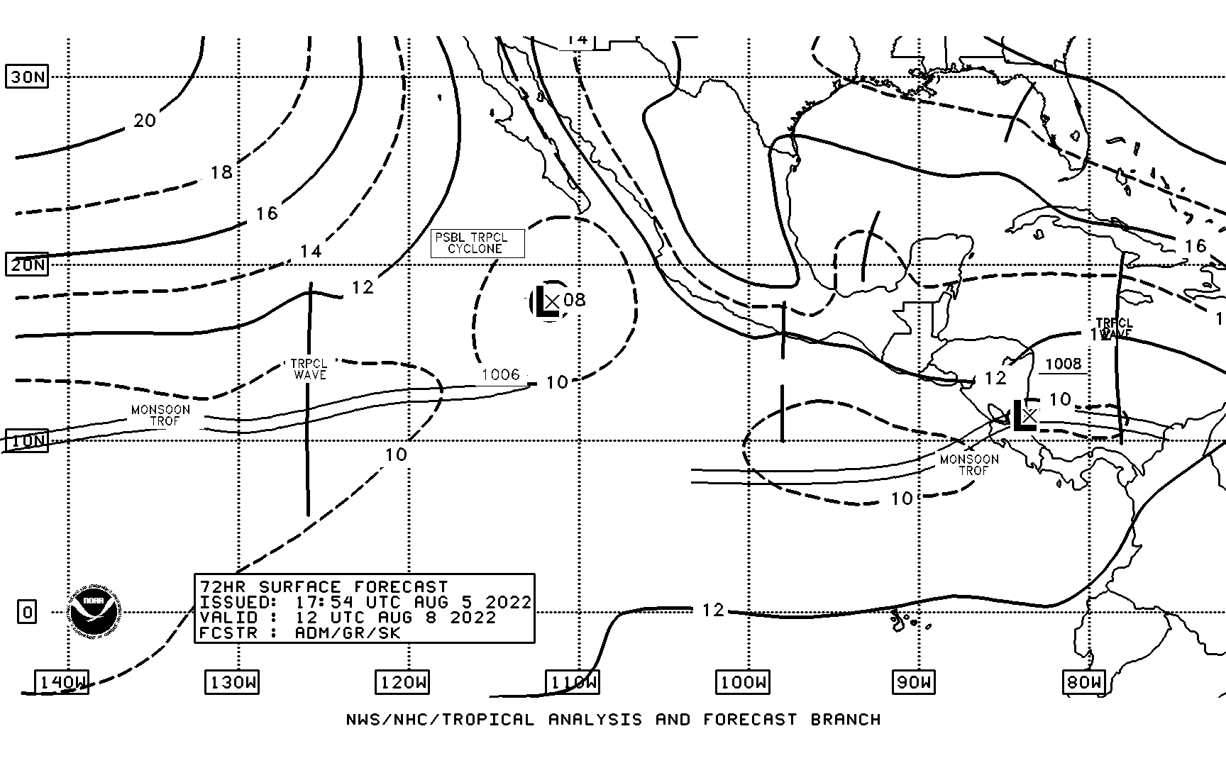
Next 72 Hours Surface Forecast – North / Central Pacific
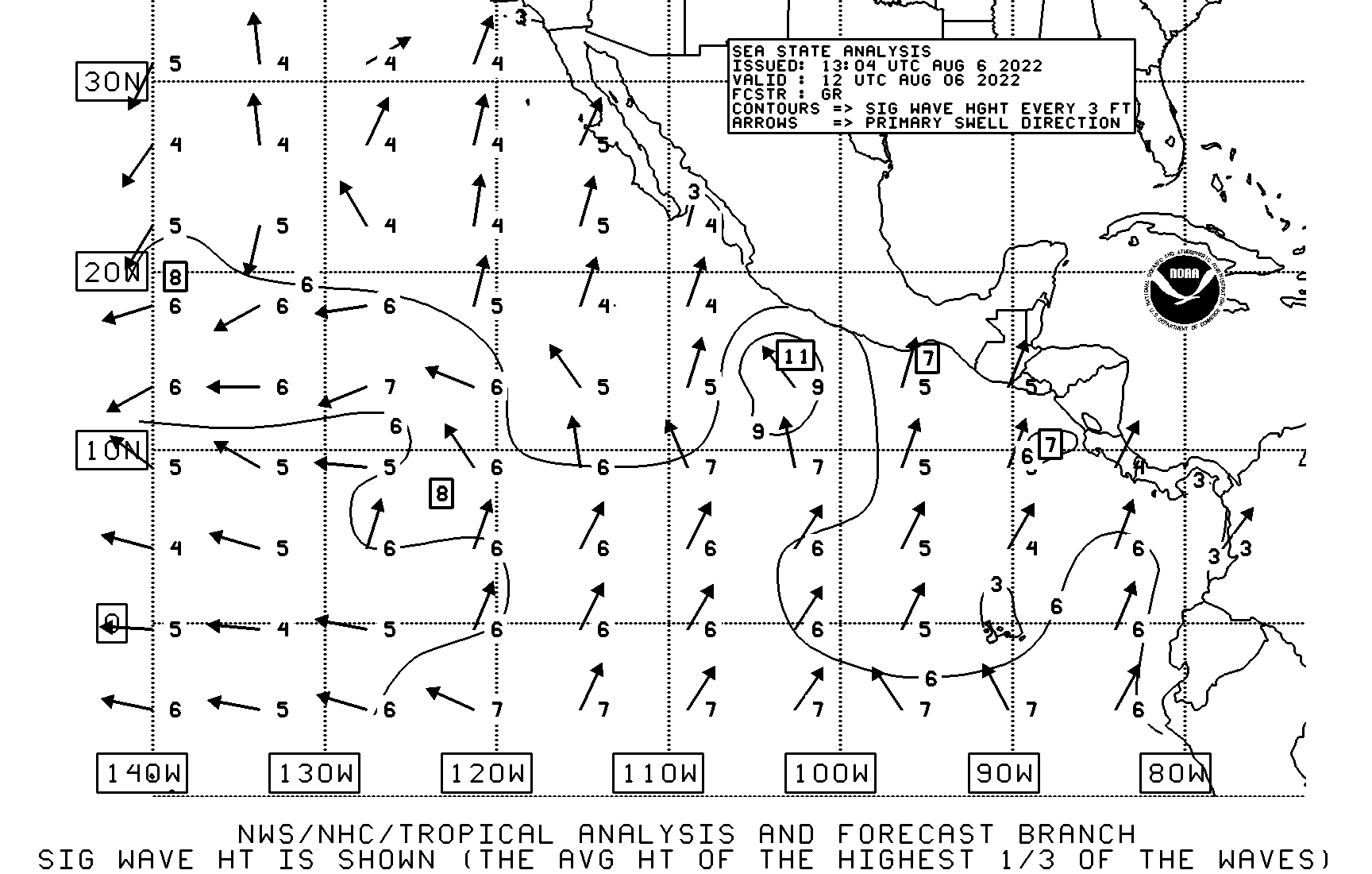
Wave Height – Pacific