“A cold front is coming through”
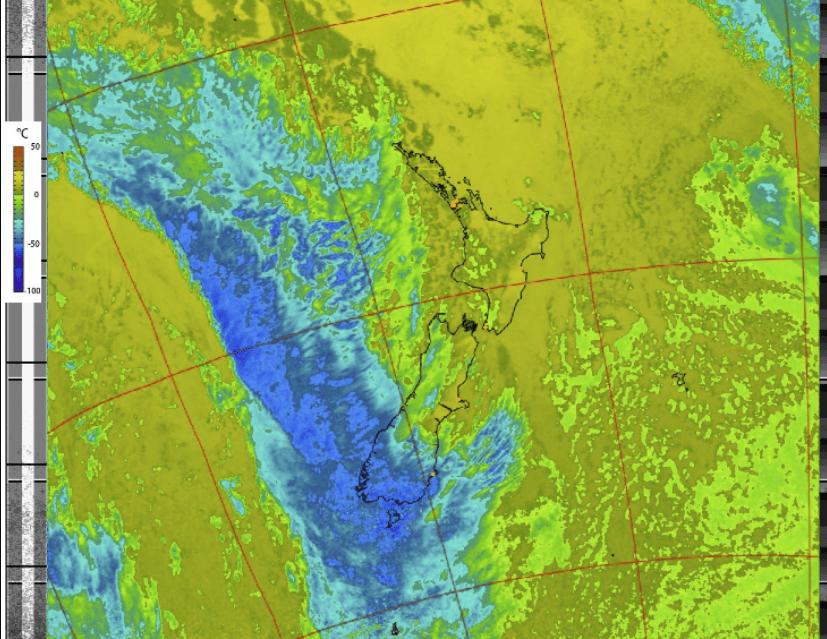
How often have you heard a weather forecaster say that a cold front is passing through? This air temperature processed image from NOAA 18 for a pass this morning at 9:46 local time here in NZ really is a perfect example of a cold front.
The blue area shows how the air really is colder compared to the rest of the air around NZ which is significantly warmer.
To look how the professional weather forecasters convert data like this, looking at the NZ Met Office site has this as the national forecast.
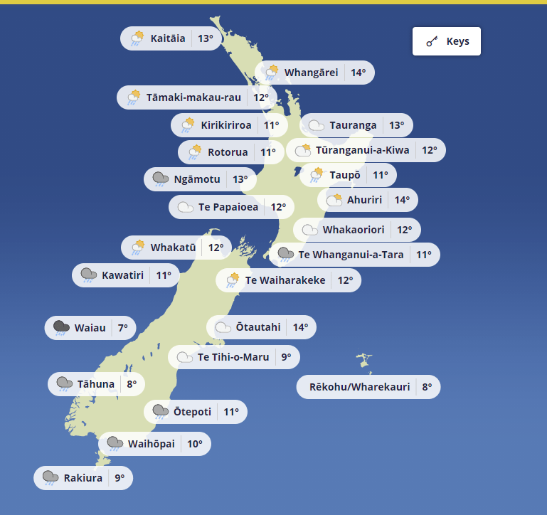
It is easy to compare the satellite image and see how this is predicting lower temperatures across where this cold front is already, plus the weather symbols are clearly showing it is raining too.
Looks like Monday will be a day to stay indoors and to keep warm.