GOES 17 – Success
I’ve been waiting about 3 weeks for the Nooelec GOES SAWbird to arrive, which is a low noise amplifier coupled with a band pass filter which only allows the satellite frequency through. It had gone on a journey around the US, then to Japan and finally to New Zealand.
So being the weekend I was ready to start to see if the SAWbird was the magical item to start to get reception, plus it wasn’t raining too, which is important when you’ve not got a waterproofed set up!
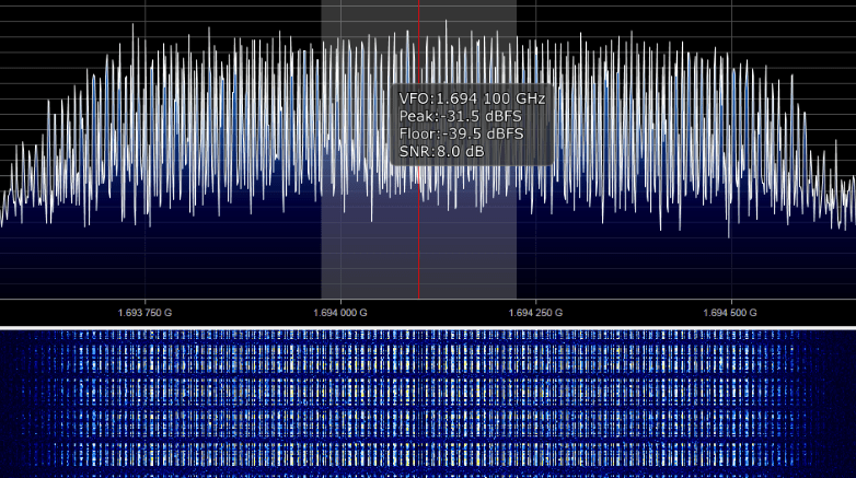
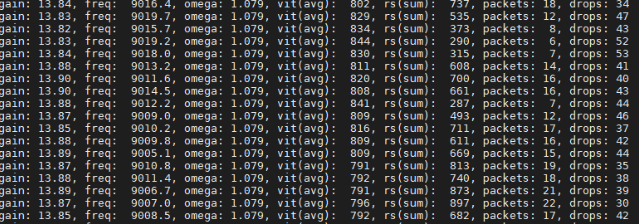
Using SDR#, it was clear that there was a distinct improvement, so then it was a matter of getting everything set up to use the Raspberry Pi to try to decode the data. For this to happen, the vit(avg) value needs to be below 800, with the lower the better. It took a lot of making very small changes to where the dish was pointing and with some help for the values I should be using for the sample rate and gain (thanks Nullpainter!) before I was able to get it low enough.
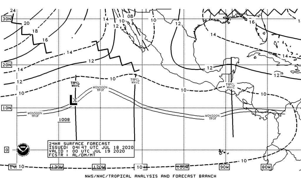
Then it was a matter of kicking off the decoder and waiting, impatiently, for something to happen. I soon had my first image downloaded, which was a forecast from NOAA showing weather systems to the west of central America. Not the most beautiful of images but it was something!
Then waiting to see what would come next, there were a few images showing zoomed in detail for parts of the US.
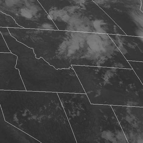
I’ve downloaded an image every ten minutes for this area, which will be so that the evolution of the weather system at the top middle of the image can be followed.
This was almost like going through a box of chocolates, ignoring the selection guide and wondering what I’d see next.
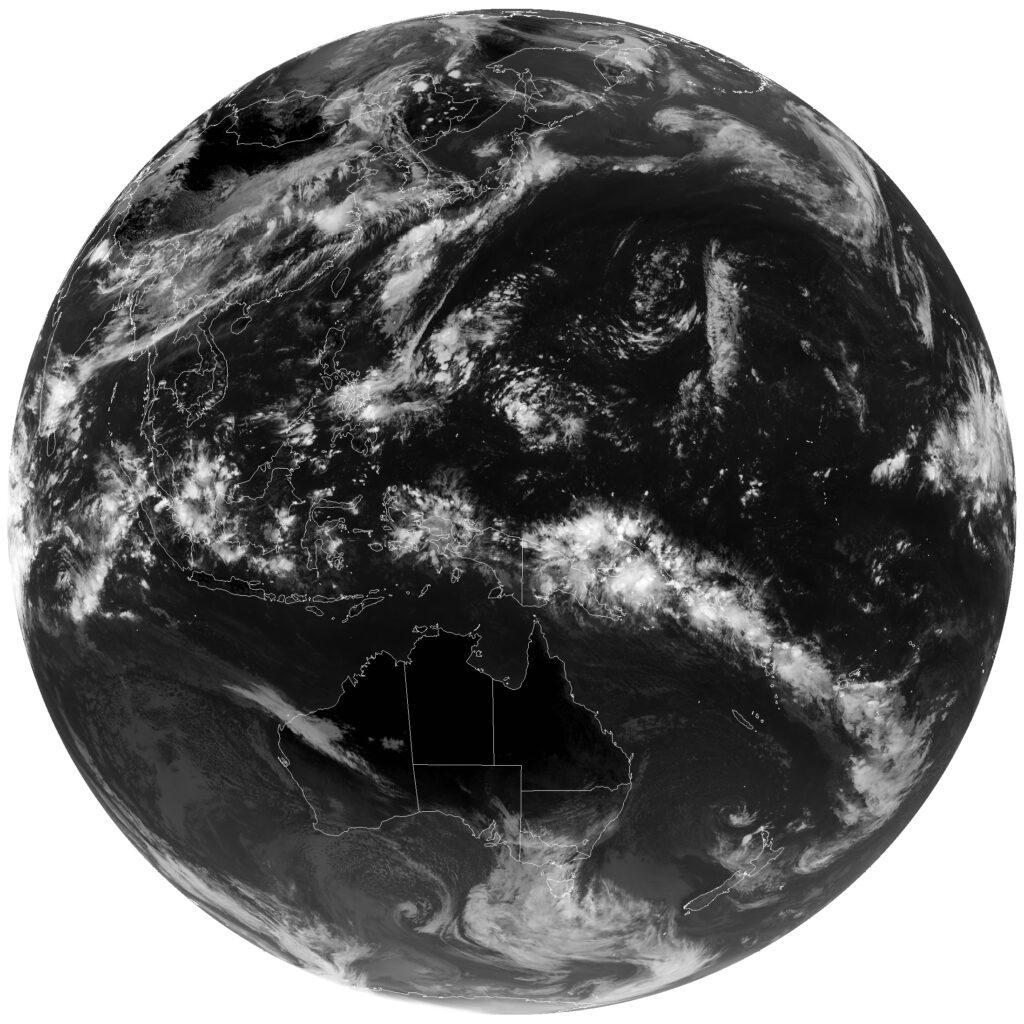
The next was a set of three images from the Himawari 8 satellite which is a Japanese satellite. These images are normally only available to Country level Meteorological offices, with the data downloads being encrypted, but they are also shared via GOES 16 / 17 for anyone to pick up.
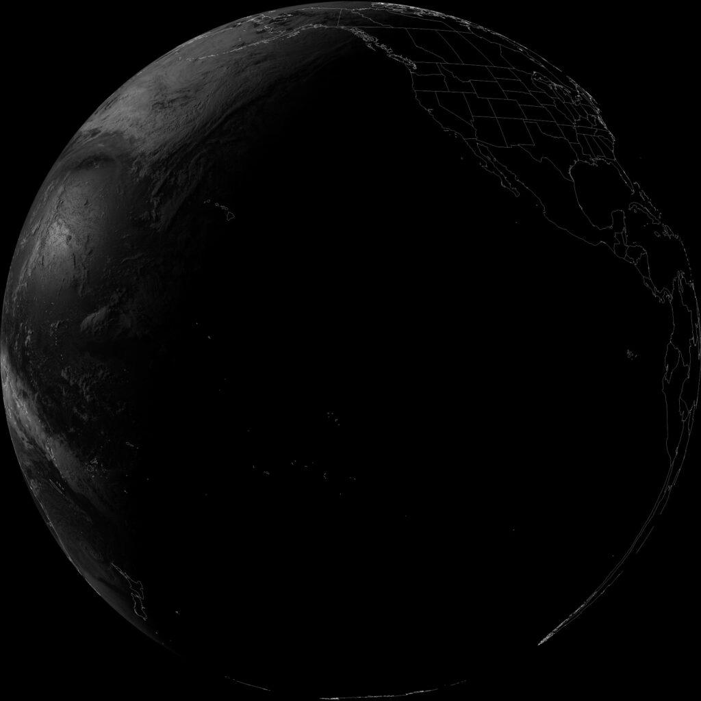
Next was a GOES 17 full disc image from channel 2 (visible red) which shows this side of the earth to be mainly in darkness, with dusk just about to arrive over New Zealand.
Another image from channel 8 (Upper-Level Water Vapor) shows how water vapor is distributed across the upper atmosphere.
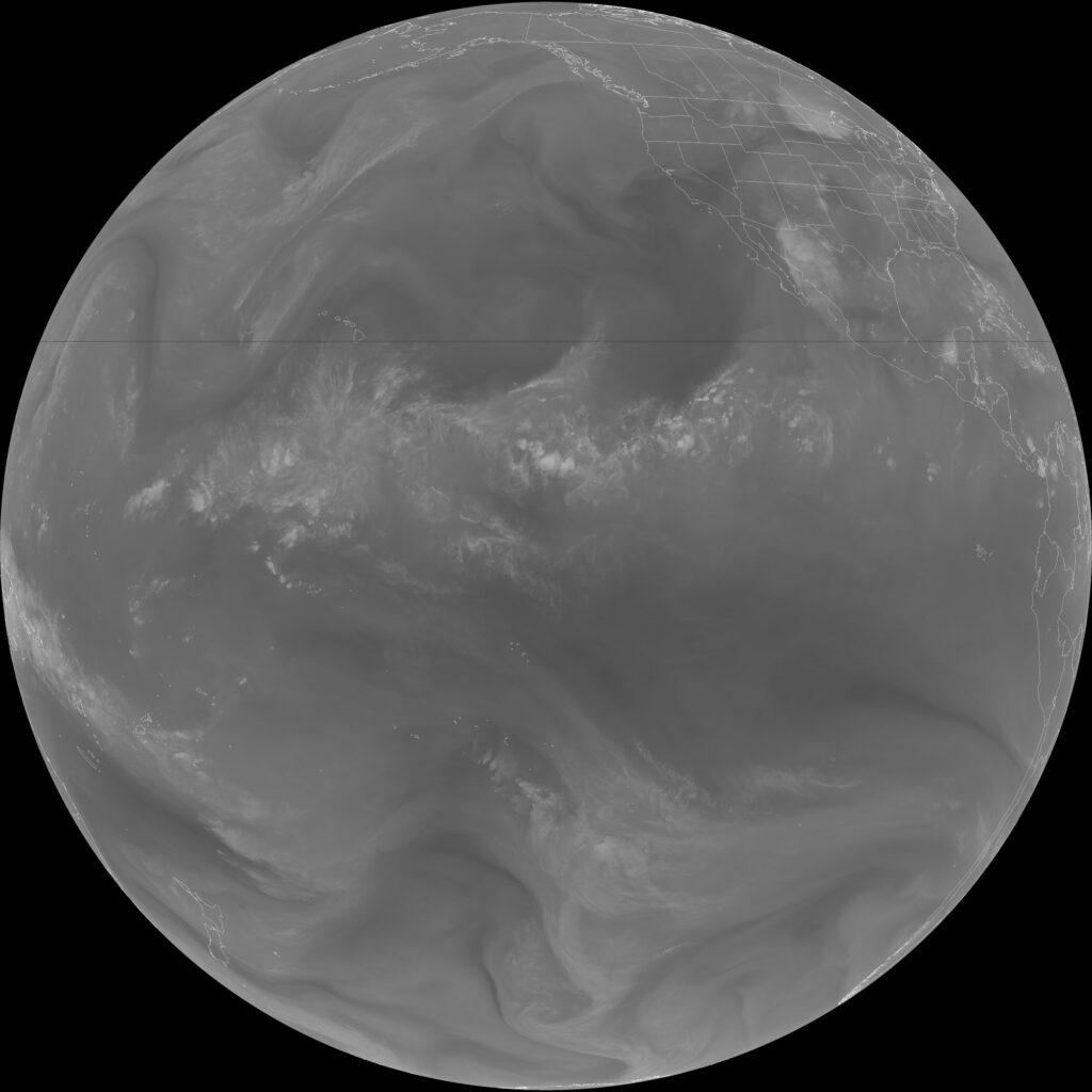
These GOES images are 5424 x 5424 pixels, which is above what I can directly link in these images with a stunning level of detail.
Next steps are to:
- Identify how to set this up permanently and not having it sat inside a bedroom pointing out of a window (it is winter and not too warm overnight!)
- Determine how to weather proof the electronics which need to be outside
- Understand all the satellites and images that will be downloaded
- Incorporate the downloads so they are accessible from the kiwiweather.com website
Plus of course ensure that the NOAA 15/18/19 and Meteor M-2 images work too. I think I may have corrected the problem which was with two SMA connectors being loosened so that the central pin was not giving solid contact with the connector. This was a result of some heavy wind / rain from a storm system. So hoping to validate this is working with some passes tonight.